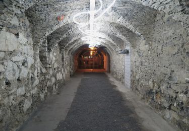
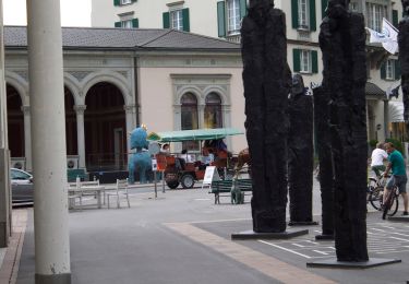
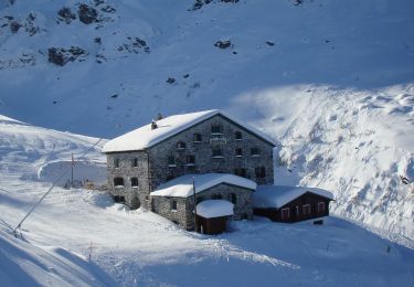
![](/images/other/stat-length.png)
![Tour Andere Aktivitäten Bad Ragaz - SG / pardiel - obersäss - pizolhütte - pardiel - Photo](https://media.geolcdn.com/t/1900/400/ext.pjpeg?maxdim=2&url=https%3A%2F%2Fstatic1.geolcdn.com%2Fsiteimages%2Fupload%2Ffiles%2F1545311037marcheuse_200dpi.jpg)
SG / pardiel - obersäss - pizolhütte - pardiel
denisewanderige
Benutzer
![Länge](/images/other/stat-length.png)
Länge
11,3 km
![Maximale Höhe](https://static1.geolcdn.com/siteimages/upload/files/1508320355ic_sort_altitude_max_24dp.png)
Maximale Höhe
2221 m
![Positive Höhendifferenz](https://static1.geolcdn.com/siteimages/upload/files/1508320355ic_sort_den_pos_24dp.png)
Positive Höhendifferenz
656 m
![Km-Effort](/images/other/stat-length.png)
Km-Effort
20 km
![Min. Höhe](https://static1.geolcdn.com/siteimages/upload/files/1508320355ic_sort_altitude_min_24dp.png)
Min. Höhe
1625 m
![Negative Höhendifferenz](https://static1.geolcdn.com/siteimages/upload/files/1508320355ic_sort_den_neg_24dp.png)
Negative Höhendifferenz
656 m
![Boucle](https://static1.geolcdn.com/siteimages/upload/files/16400158638029165_repeat_loop_refresh_sync_direction_icon.png)
Boucle
Ja
Erstellungsdatum :
2014-12-11 00:00:00.0
Letzte Änderung :
2014-12-11 00:00:00.0
![Andere Aktivitäten](https://static1.geolcdn.com/sitytour/trail-icons/900.png)
--
Schwierigkeit : Unbekannt
![Scannen Sie diesen QR-Code, um die Tour in der SityTrail-Anwendung zu öffnen](https://capi.geolives.com/qq0zvz2zws4bq2lad0pu/sitytour/trails/19465/qr.png?size=200)
Kostenlosegpshiking-Anwendung
Über SityTrail
Tour Andere Aktivitäten von 11,3 km verfügbar auf Sankt Gallen, Wahlkreis Sarganserland, Bad Ragaz. Diese Tour wird von denisewanderige vorgeschlagen.
Beschreibung
Details (Wanderbeschrieb, Fotos, Dauer, Links, usw.) siehe unter:
http://www.wanderige.ch/wanderige_toure/2006/pizol/pizol.htm
Ort
Land:
Switzerland
Region :
Sankt Gallen
Abteilung/Provinz :
Wahlkreis Sarganserland
Kommune :
Bad Ragaz
Standort:
Unknown
Gehen Sie:(Dec)
Gehen Sie:(UTM)
535268 ; 5204130 (32T) N.
Kommentare
Touren in der Umgebung
![Tour Zu Fuß Pfäfers - Pfäfers - Spig - Photo](https://media.geolcdn.com/t/375/260/960a57d7-2229-4f75-a454-13f455f6e1e8.jpeg&format=jpg&maxdim=2)
![Zu Fuß Zu Fuß](https://static1.geolcdn.com/sitytour/trail-icons/100.png)
Pfäfers - Spig
Zu Fuß
Einfach
Pfäfers,
Sankt Gallen,
Wahlkreis Sarganserland,
Switzerland
![](/images/other/stat-length.png)
3,8 km | 7,5 km-effort
1h 41min
![](https://static1.geolcdn.com/siteimages/upload/files/16400158638029165_repeat_loop_refresh_sync_direction_icon.png)
Nein
![Tour Zu Fuß Pfäfers - Bad Pfäfers - Pfäfers - Photo](https://media.geolcdn.com/t/375/260/4c6ea9a3-1f12-4209-af1f-6fbd72b66fe4.jpeg&format=jpg&maxdim=2)
![Zu Fuß Zu Fuß](https://static1.geolcdn.com/sitytour/trail-icons/100.png)
Bad Pfäfers - Pfäfers
Zu Fuß
Einfach
Pfäfers,
Sankt Gallen,
Wahlkreis Sarganserland,
Switzerland
![](/images/other/stat-length.png)
3,6 km | 6 km-effort
1h 21min
![](https://static1.geolcdn.com/siteimages/upload/files/16400158638029165_repeat_loop_refresh_sync_direction_icon.png)
Nein
![Tour Zu Fuß Vilters-Wangs - Garschlu - Bad Ragaz - Photo](https://media.geolcdn.com/t/375/260/ad10575f-3adb-4e89-9620-1a4c222a171a.jpeg&format=jpg&maxdim=2)
![Zu Fuß Zu Fuß](https://static1.geolcdn.com/sitytour/trail-icons/100.png)
Garschlu - Bad Ragaz
Zu Fuß
Einfach
Vilters-Wangs,
Sankt Gallen,
Wahlkreis Sarganserland,
Switzerland
![](/images/other/stat-length.png)
8,7 km | 12,1 km-effort
2h 45min
![](https://static1.geolcdn.com/siteimages/upload/files/16400158638029165_repeat_loop_refresh_sync_direction_icon.png)
Nein
![Tour Zu Fuß Vilters-Wangs - 5-Seen-Wanderung - Photo](https://media.geolcdn.com/t/375/260/dev_293debdd-eb52-40e8-a7c4-af32ae64913b.jpeg&format=jpg&maxdim=2)
![Zu Fuß Zu Fuß](https://static1.geolcdn.com/sitytour/trail-icons/100.png)
5-Seen-Wanderung
Zu Fuß
Einfach
Vilters-Wangs,
Sankt Gallen,
Wahlkreis Sarganserland,
Switzerland
![](/images/other/stat-length.png)
9,8 km | 18,1 km-effort
4h 7min
![](https://static1.geolcdn.com/siteimages/upload/files/16400158638029165_repeat_loop_refresh_sync_direction_icon.png)
Nein
![Tour Zu Fuß Vilters-Wangs - Garmil-Höhenwanderung - Photo](https://media.geolcdn.com/t/375/260/28ba02fa-c2ee-44af-8fc9-614ecdb77080.jpeg&format=jpg&maxdim=2)
![Zu Fuß Zu Fuß](https://static1.geolcdn.com/sitytour/trail-icons/100.png)
Garmil-Höhenwanderung
Zu Fuß
Einfach
Vilters-Wangs,
Sankt Gallen,
Wahlkreis Sarganserland,
Switzerland
![](/images/other/stat-length.png)
6,2 km | 10,7 km-effort
2h 25min
![](https://static1.geolcdn.com/siteimages/upload/files/16400158638029165_repeat_loop_refresh_sync_direction_icon.png)
Nein
![Tour Andere Aktivitäten Bad Ragaz - st_ral_10_03 - Photo](https://media.geolcdn.com/t/375/260/ext.jpg?maxdim=2&url=https%3A%2F%2Fstatic1.geolcdn.com%2Fsiteimages%2Fupload%2Ffiles%2F1545311037marcheuse_200dpi.jpg)
![Andere Aktivitäten Andere Aktivitäten](https://static1.geolcdn.com/sitytour/trail-icons/900.png)
st_ral_10_03
Andere Aktivitäten
Sehr leicht
Bad Ragaz,
Sankt Gallen,
Wahlkreis Sarganserland,
Switzerland
![](/images/other/stat-length.png)
46 km | 66 km-effort
17h 1min
![](https://static1.geolcdn.com/siteimages/upload/files/16400158638029165_repeat_loop_refresh_sync_direction_icon.png)
Nein
![Tour Wandern Vilters-Wangs - hike22 - Photo](https://media.geolcdn.com/t/375/260/ext.jpg?maxdim=2&url=https%3A%2F%2Fstatic1.geolcdn.com%2Fsiteimages%2Fupload%2Ffiles%2F1553511878bg_sport_marche.png)
![Wandern Wandern](https://static1.geolcdn.com/sitytour/trail-icons/101.png)
hike22
Wandern
Sehr leicht
Vilters-Wangs,
Sankt Gallen,
Wahlkreis Sarganserland,
Switzerland
![](/images/other/stat-length.png)
10,6 km | 19,4 km-effort
Unbekannt
![](https://static1.geolcdn.com/siteimages/upload/files/16400158638029165_repeat_loop_refresh_sync_direction_icon.png)
Nein
![Tour Zu Fuß Bad Ragaz - Heidipfad - Photo](https://media.geolcdn.com/t/375/260/ext.jpg?maxdim=2&url=https%3A%2F%2Fstatic1.geolcdn.com%2Fsiteimages%2Fupload%2Ffiles%2F1545311037marcheuse_200dpi.jpg)
![Zu Fuß Zu Fuß](https://static1.geolcdn.com/sitytour/trail-icons/100.png)
Heidipfad
Zu Fuß
Einfach
Bad Ragaz,
Sankt Gallen,
Wahlkreis Sarganserland,
Switzerland
![](/images/other/stat-length.png)
4 km | 5,8 km-effort
1h 19min
![](https://static1.geolcdn.com/siteimages/upload/files/16400158638029165_repeat_loop_refresh_sync_direction_icon.png)
Ja
![Tour Zu Fuß Fläsch - Flaesch (CH) - Neuwald (CH) - Maels - Photo](https://media.geolcdn.com/t/375/260/ext.jpg?maxdim=2&url=https%3A%2F%2Fstatic1.geolcdn.com%2Fsiteimages%2Fupload%2Ffiles%2F1545311037marcheuse_200dpi.jpg)
![Zu Fuß Zu Fuß](https://static1.geolcdn.com/sitytour/trail-icons/100.png)
Flaesch (CH) - Neuwald (CH) - Maels
Zu Fuß
Einfach
Fläsch,
Graubünden,
Landquart,
Switzerland
![](/images/other/stat-length.png)
8,2 km | 13,6 km-effort
3h 5min
![](https://static1.geolcdn.com/siteimages/upload/files/16400158638029165_repeat_loop_refresh_sync_direction_icon.png)
Nein